Part 3: Reinvesting in the Streets
From Washington Boulevard in Stamford to Wall Street in Norwalk, see how communities are reinvesting in their roads to make them safer and more accessible.
Across southwest Connecticut, there are many dangerous and confusing roads that are challenging for all users—drivers, pedestrians, and cyclists—to navigate. However, some cities are now working to make these roads safer and easier to use, thanks in part to many federal and state grant programs. We explored a few projects taking place in communities across the region.
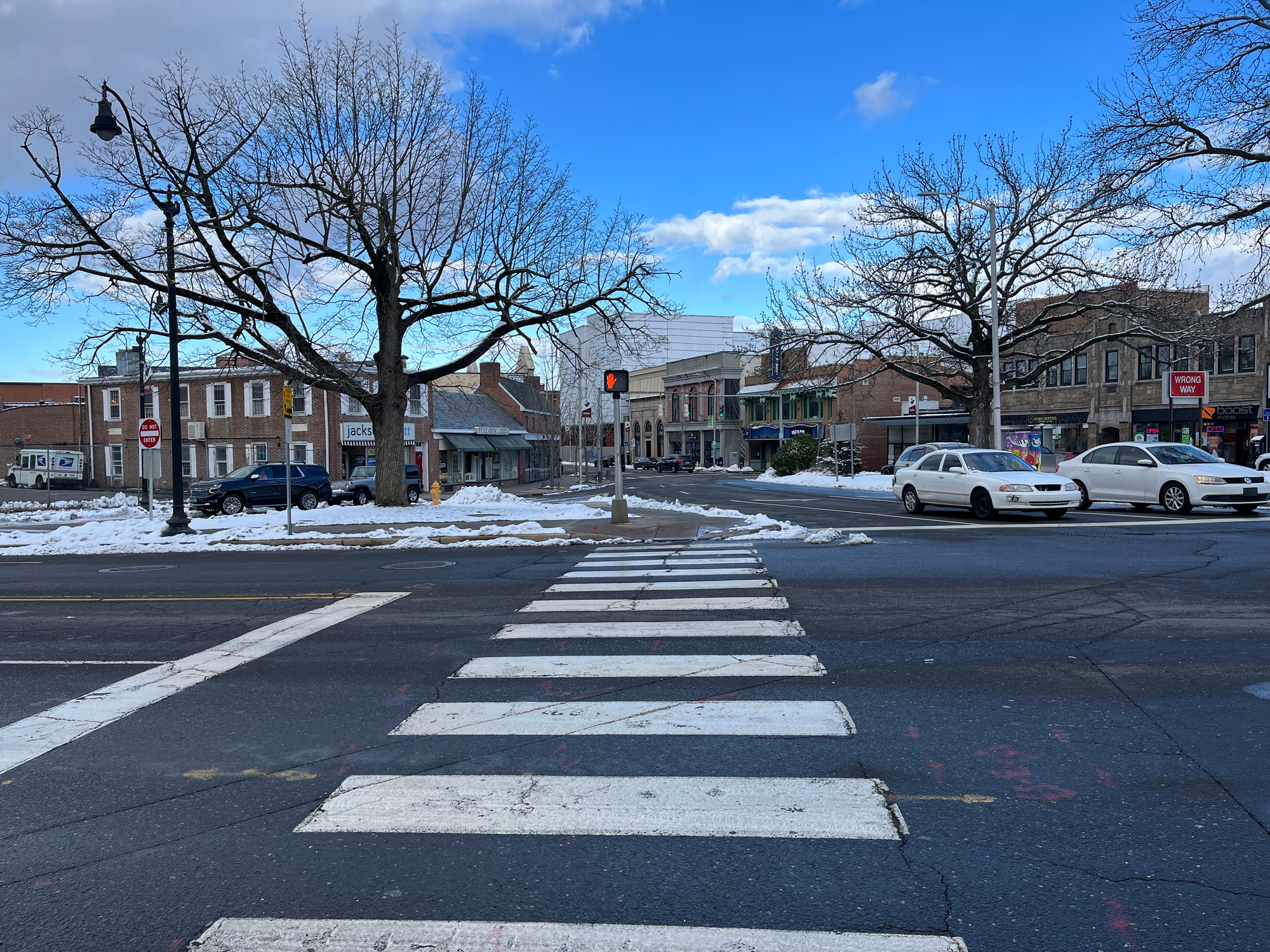
Stamford
Washington Boulevard
Washington Boulevard, with its infamous nickname the “Boulevard of Death,” is the deadliest road in the city with four pedestrian deaths on the road in the last three years. While the road runs through the city, it is a state-run road meaning the state is responsible for the upgrades and infrastructure on it.
After two pedestrians were killed in December 2022, the city and the state’s Department of Transportation teamed up to conduct a Road Safety Audit that outlined ways the road could be made safer, as well as some quick build projects to put in place immediately.
The city so far has received state funding to “formally build out improvements” for two intersections on the road—Washington Boulevard and Main Street with a raised intersection, new traffic signal, and bump outs, and Washington Boulevard and Richmond Hill Avenue for a raised intersection.
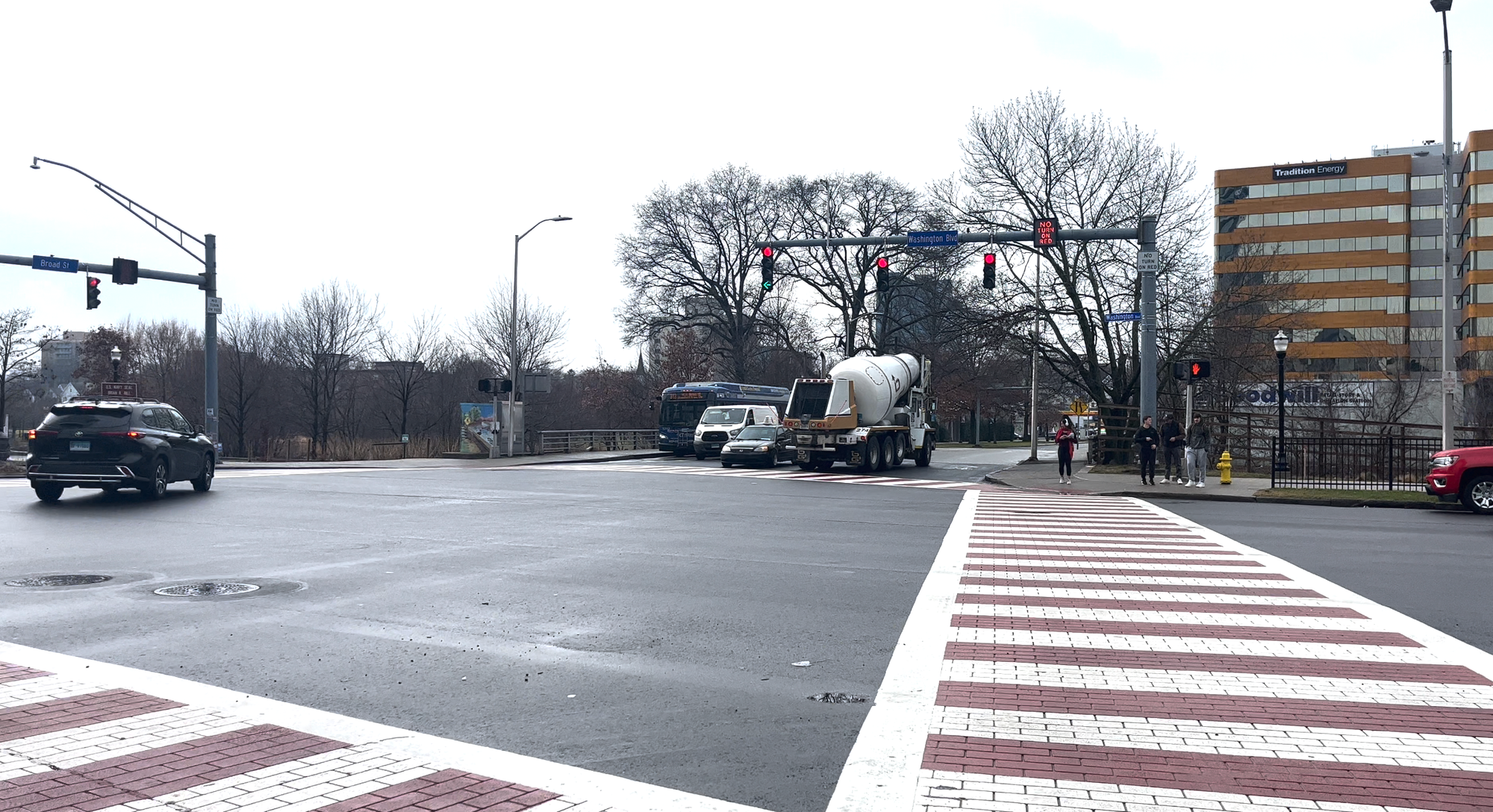
In addition, the state and city are working on “quick build safety projects” including enhancements at Washington Boulevard and four roads—Broad Street, Main Street, Richmond Hill Avenue, and North State Street. Those quick projects include: adding hardened centerline speed humps to slow left turning vehicles; creating delineated bump outs to slow down right-turning vehicles, make it a shorter distance for pedestrians to cross and improve visibility; and closing lanes to shorten crossing distances.
All of these are quick build projects meaning they can be removed and are temporary. The city said these “treatments are being undertaken on a pilot basis to inform future capital construction to improve safety at this intersection.”
Greenwich Avenue Corridor
As part of efforts to “relieve historical congestion issues in the Waterside Village Neighborhood,” the city has been working on improving the Greenwich Avenue corridor. The improvements include three parts that when together, city officials said would “offer significant improvements to pedestrian, cyclist, and vehicle mobility.”
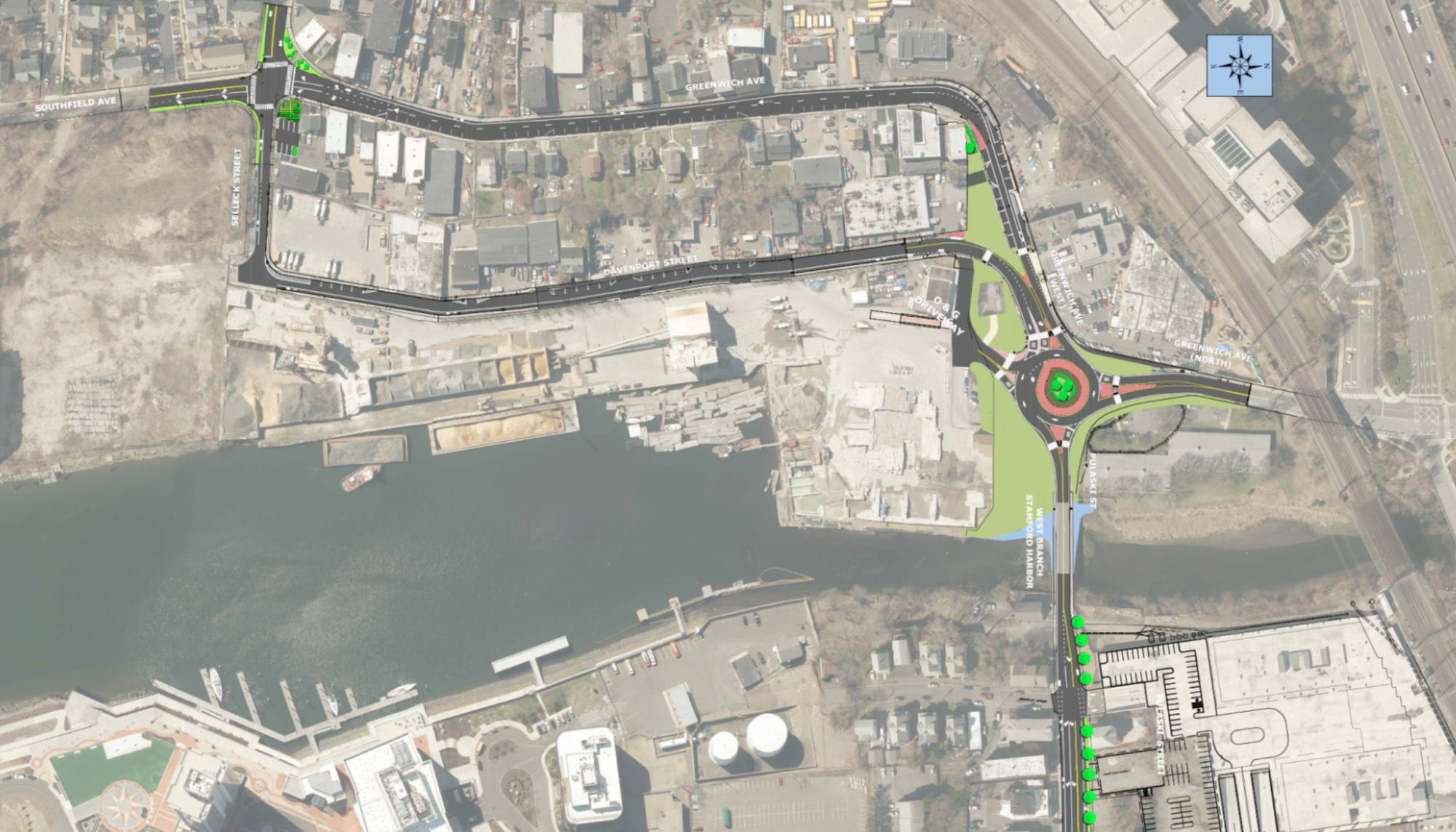
Part one is the first roundabout in Stamford, which is under construction at Greenwich Avenue and Pulaski Street. The city plans to transform the all-way stop intersection into a roundabout to help keep traffic flowing. It will also include “high-visibility” pedestrian crossings to make it easier for those walking to navigate it.
The second part includes turning Greenwich Avenue and Davenport Street into a “one-way circulator.” Greenwich Avenue will be a one-way road going south and loop with Davenport, which will be one-way going north.
“The project will provide significant capacity improvements to Greenwich Avenue,” according to a statement from the city. “Davenport Street will be restored and repaved to improve traffic flow, a bike lane will be provided to accommodate cyclists and existing pedestrian facilities will be improved.”
Parts one and two are currently under construction and scheduled to wrap up later this summer.
The third part, intersection improvements at Greenwich Avenue, Southfield Avenue, and Selleck Street, has finished. This project included upgrading the traffic signals, adding turning lanes, providing ADA-compliant pedestrian curb ramps and crosswalks, and creating a new community parking lot for nearby local businesses.
Norwalk
Wall Street
For years, the Wall Street corridor has been neglected with confusing parking alignments, complicated intersections, and the lack of a streetscape. But over the past few years, officials from the city’s Transportation, Mobility, and Parking department have committed to reenvisioning how the corridor looks and adding improvements to make it more accessible to bikers and walkers.
“This is a tremendous project—very few municipalities have the opportunity to reimagine their downtown,” Garrett Bolella, the city’s assistant director of Transportation, Mobility, and Parking told the Common Council in June.
Norwalk has unveiled a $25+ million plan to improve the corridor—of which they’ve secured about $18.4 million in grant funding to cover—including:
- Realigning the Belden, West, and Wall Street intersection to make it easier for cars, pedestrians, and cyclists to navigate with clearer lane markings, shorter crossing distances, and improved streetscape.
- Adding a traffic circle to Burnell Boulevard and Main Street to help circulate traffic and make Burnell a two-way street. There would also be improved connections to the Norwalk Transit facility there.
- Putting in “Gateways” or signs that cross over the street to give it a sense of place for those who travel there.
- Creating shorter pedestrian crossings and raising crosswalks—similar to how they are on Washington Street—throughout.
- Adding additional lighting and street trees to make the streets more inviting to walk along.
- Integrating arts and cultural pieces that already exist, such as local murals, as well as adding to them with colorful crosswalks and pieces.
- Turning River Street into a “festival street” with more plantings and a brick-like design.
- Expanding and adding better access to Freese Park as well as better connecting the corridor to the Norwalk River Valley Trail and Harbor Loop, as well as to the Yankee Doodle Garage.
The plans are broken into three phases with the first phase involving the East Wall Street area. The main construction work is set to begin in August.
Hospital Hill
One of the most confusing intersections in the city is getting a redo thanks to an $800,000 Community Connectivity Grant from the state. The intersection of Stuart Avenue, Stevens Street, and Magnolia Avenue is a “high crash intersection,” with confusing traffic patterns according to city officials.
“We thought this intersection fit perfectly. It had a history of crashes,” Bolella said. “We actually had a number of different pedestrian crashes—three [pedestrian] crashes is a pretty big number for the amount of vehicles that are entering this intersection–and then we also have a history of parking-related crashes and crashes just related to confusion.”
In addition to realigning the intersection to make it safer, the project also calls for neighborhood improvements, including spaces for outdoor dining, a new parking area, lighting upgrades, street trees, and the incorporation of Complete Streets practices to make it easier for pedestrians, bicyclists, and drivers to navigate the area.
The plan is to get the project designed by the end of summer and put it out for construction bids in the early fall, as there’s “a lot of elements of the project that can be done over the winter,” according to Bolella.
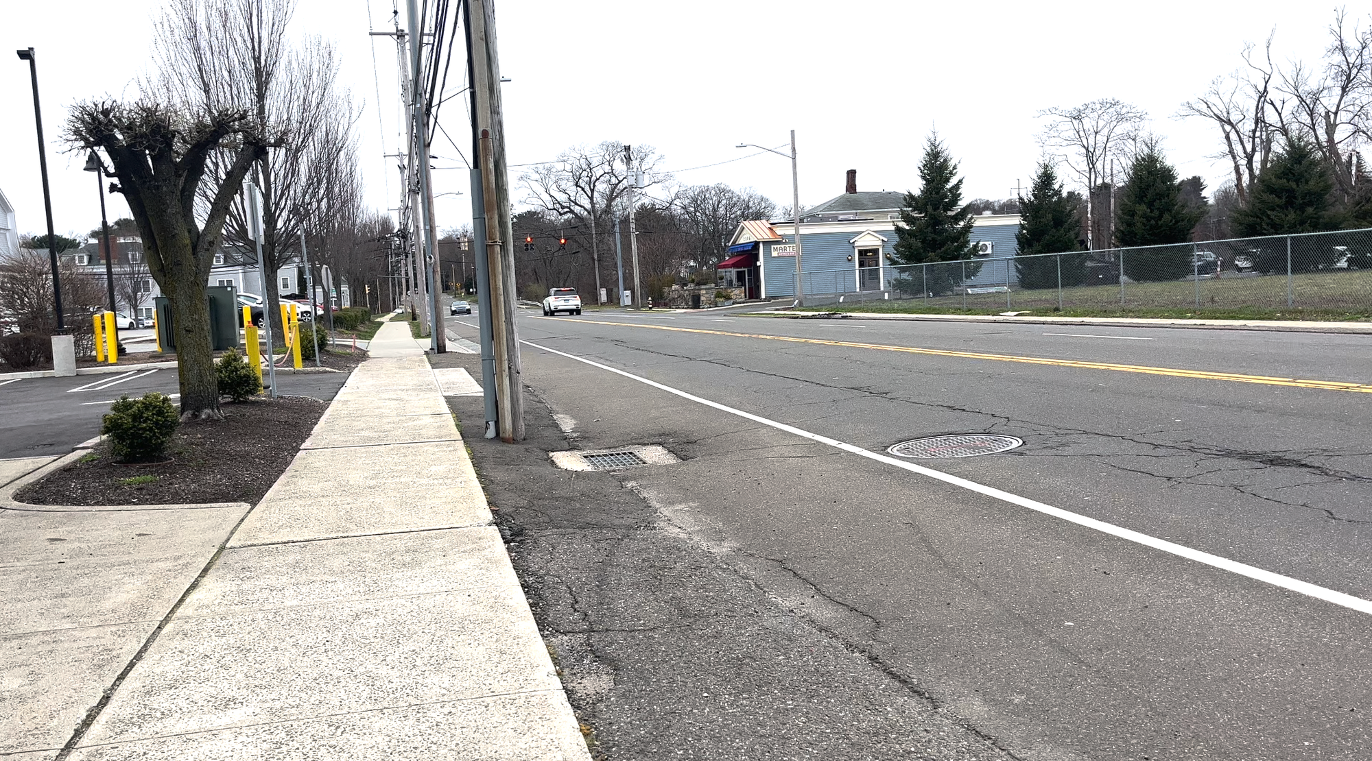
Fairfield
Post Road
The Connecticut Department of Transportation is working on a road diet project for a one-mile stretch of Post Road, also known as U.S. Route 1, which runs from about Rennell to Beaumont Street.
The plans call for turning the four-lane road, with two travel lanes in each direction, into a two-lane road with one lane in each direction and a turning lane or median in the center.
“With this project, we hope to enhance safety, mobility, and access for all road users—motorists, cyclists, and pedestrians,” Jonathan Corilla, the project manager, said at an April public meeting.
The goals of the project include improving safety, calming traffic, making it more accessible for all users, providing operational benefits to the area around it, and enhancing the overall quality of life.
Mark Vertucci, a consultant with Fuss & O’Neill who is working on the project, said the stretch of roadway is a good candidate for a roadway diet as it averages about 14,500 daily car trips a day.

Vertucci noted that the corridor is “very hostile to bicyclists and pedestrians today.”
Chris Lockhart, the project engineer, said over the past five years there have been nearly 200 crashes in the corridor, and of those 139 were “turning-related” where people were attempting to cross traffic to turn into a side street or driveway. There were at least 30 crashes with some kind of injury.
“That’s what the road diet seeks to improve by 26% overall—over the next five that would lead to 140 crashes which is much better than 194,” he said.
Vertucci said moving to one lane of traffic in each direction improves sightlines for vehicles and reduces the amount of lanes people have to cross into.
“It’s a safer condition on multiple fronts, it reduces rear end collisions as well,” he said.
The improvements would also make it better for pedestrians, as they have to cross fewer lanes of traffic, and for cyclists as there now would be shoulders instead of having them ride directly in traffic.
CTDOT estimates the total cost of the project would be $1.86 million, which also includes traffic signal adjustments and upgrades, storm drainage structure improvements, and sidewalk upgrades.
Westport
In 2022, the town kicked off a series of traffic and pedestrian safety meetings that aimed to bring together residents and Westport officials to “discuss traffic issues in their neighborhoods.”
First Selectwoman Jen Tooker put together a task force of officials from various departments including police, fire, public works, and planning and zoning that looked at residents’ requests, concerns, and ideas to create a list of projects, which were sorted into three tiers:
- Green: projects that were already in process in town or would be easy to plan, design, and complete
- Yellow: projects that would require more planning, effort, and/or funding than the green projects
- Red: projects that the town deemed “too cost prohibitive or too difficult to implement.”
The town created 371 individual records for project ideas that came in. According to a report, more than 70 requests were related to enforcement, which Westport Police have begun to address. Since March 2022, the police have targeted some of the areas of concern and issued more than 700 written citations and arrested 17 people for driving under the influence and arrested 16 for traffic-related offenses.
In 2023, Westport received a Safe Streets for All (SS4A) federal grant to help it develop a “safety action plan” which Tooker said “emphasizes Westport’s continuing commitment to enhancing safety for all road users throughout our community.”
“The Traffic and Pedestrian Safety Task Force has done incredible work over the last two years and will continue in its efforts in making incremental improvements on traffic issues,” she said in a statement. “This SS4A project will run concurrently with the Task Force’s ongoing work, and will take it to the next level by providing a strategic plan for the Town. Together, we can work towards creating a safer roadway system that benefits everyone in our community now and in the future.”