Part 1: Unsafe Roads in Southwest Connecticut
Part 1 in our Getting Around Series looks at challenges on roads in southwest Connecticut.
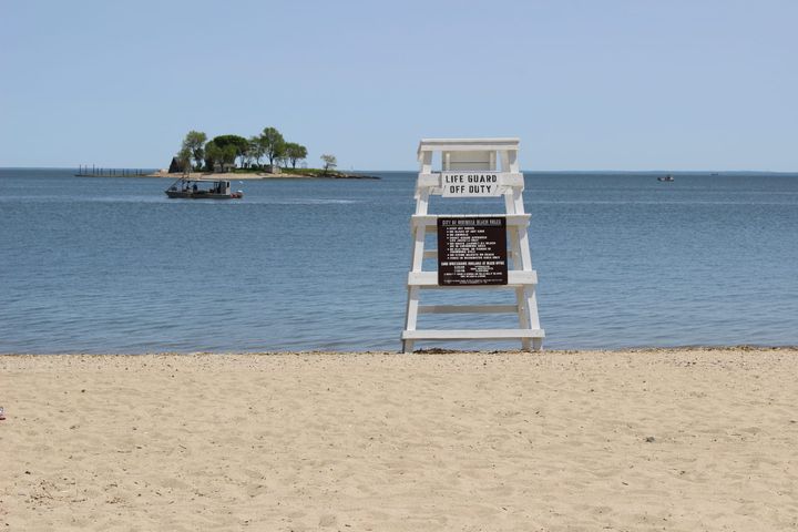
Walking across the street to pick up mail from a mailbox. Going for a walk on the side of the road. Crossing the street in a marked crosswalk.
These are just three ways that residents of southwest Connecticut lost their lives over the past two years as the region and the state as a whole grapple with a growing number of pedestrian and traffic-related deaths.
Across the state, at least 689 people lost their lives in traffic deaths in 2022 and 2023, according to data from the UCONN Connecticut Crash Data Repository. Through April 20, 2024, an additional 92 people have lost their lives in traffic deaths.
“It’s no secret that our roadways have become more deadly, and we are laser-focused on doing everything we can to ensure travelers in Connecticut are safe,” Garrett Eucalitto, commissioner of the Connecticut Department of Transportation, said in a statement.
By the Numbers: Crashes and Traffic-Related Deaths in Southwest Connecticut
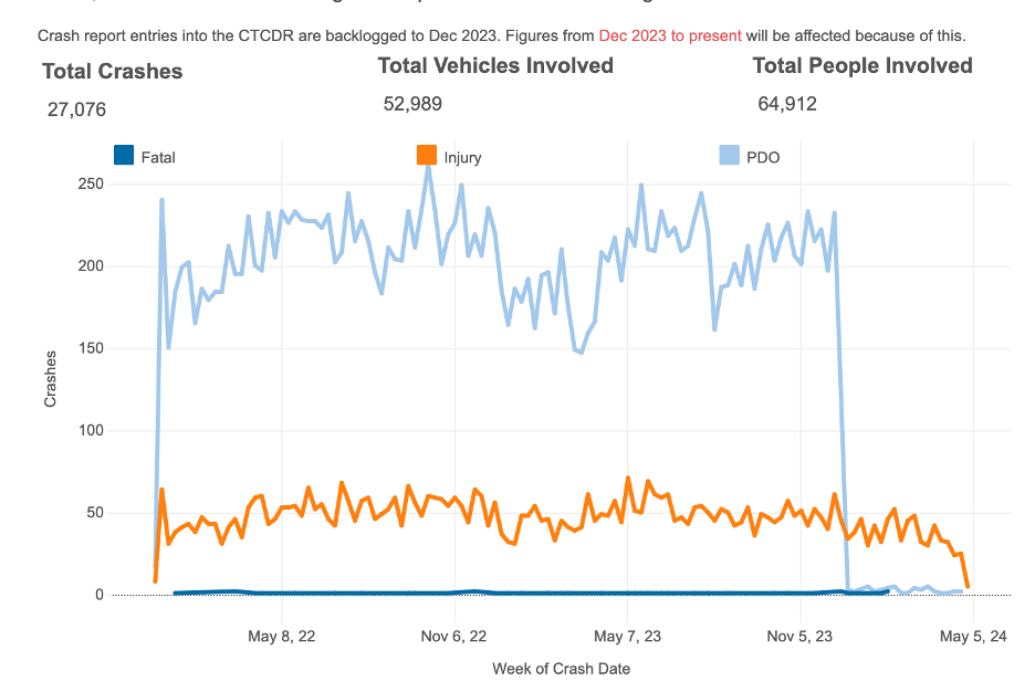
Looking just at the six communities in our coverage area—Greenwich, Stamford, Darien, Norwalk, Westport, and Fairfield—from January 2022 through April 2024, there have been more than 27,000 crashes on roads in these communities, according to the crash data repository. Those crashes involved more than 64,000 people and more than 52,000 vehicles.
There were at least 40 deaths in our region during this time caused by a crash, as well 238 serious injuries and more than 2,500 minor injuries caused by the crashes.
I-95 was home to the most total crashes, with more than 5,500, followed by U.S. Route 1 with just over 3,406, and the Merritt Parkway with 2,370.
While many of the crashes involved cars hitting other cars, 383 of the crashes involved a collision with a pedestrian, and more than 2,100 pedestrians were involved in a crash in our area.
Kerri Ann Provost, a pedestrian and road safety advocate from Hartford, started documenting pedestrian-related deaths across the state in 2020 through a “Pedestrian Murder Map”, in an effort to “help people understand how frequently pedestrians and cyclists are killed, where there are patterns of street violence in specific locations, and what role shoddy infrastructure plays.”
“I don't think people really understand how widespread this is,” she said, about why she decided to create the map. “I started to notice these really happen on certain types of roads, and the way we talk about these crashes, it tends to be as accidents. It shapes how we view the world and how we view a problem. And if you want to solve a problem, you have to know what the problem is.”
According to her map, at least 15 pedestrians have died in southwest Connecticut since 2022.
A Look into Some of the Causes Behind the Crashes
While most crashes include some type of personal responsibility from the driver—speeding, distractions, driving too closely, etc.—a growing number of pedestrian and traffic safety advocates have been pointing out that street design plays a large role.
“We see these fatalities and serious crashes happening most frequently on certain types of roads,” Provost said. “And it's not because the driver who was drunk on this road suddenly sobered up when they turned on to this other one, they are just as drunk. The difference is the road design enables a lot more foolishness to happen.”
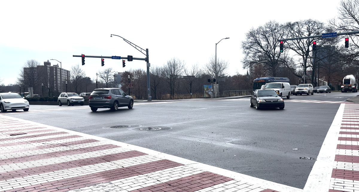
For example, Washington Boulevard in Stamford had three fatalities in 2022 from two crashes. From January 2017 through December 2021, there were a total of 547 crashes in the Washington Boulevard area, of which about 20 involved pedestrians and two involved cyclists, according to the Washington Boulevard Safety Road Audit, which was conducted after two pedestrians were killed on the road in December 2022. All but one of the crashes involving pedestrians resulted in some type of injury. The boulevard’s road design plays a large role in the number of crashes along it, according to advocates and officials.
Washington Boulevard is what advocates call a “stroad,” because it’s not really a street, and it’s not really a road, but it usually is built to move vehicles quickly through an area, making it dangerous for pedestrians.
“Usually they’re four lanes or more—some of them I've seen like places where it's eight lanes wide, and there's just a crosswalk, no median,” Provost said. “There are people who work in these stores [along the road], a lot of them are taking the bus and the speed limits are high, and often, they don't even have a separate pedestrian light. And they're usually state routes.’
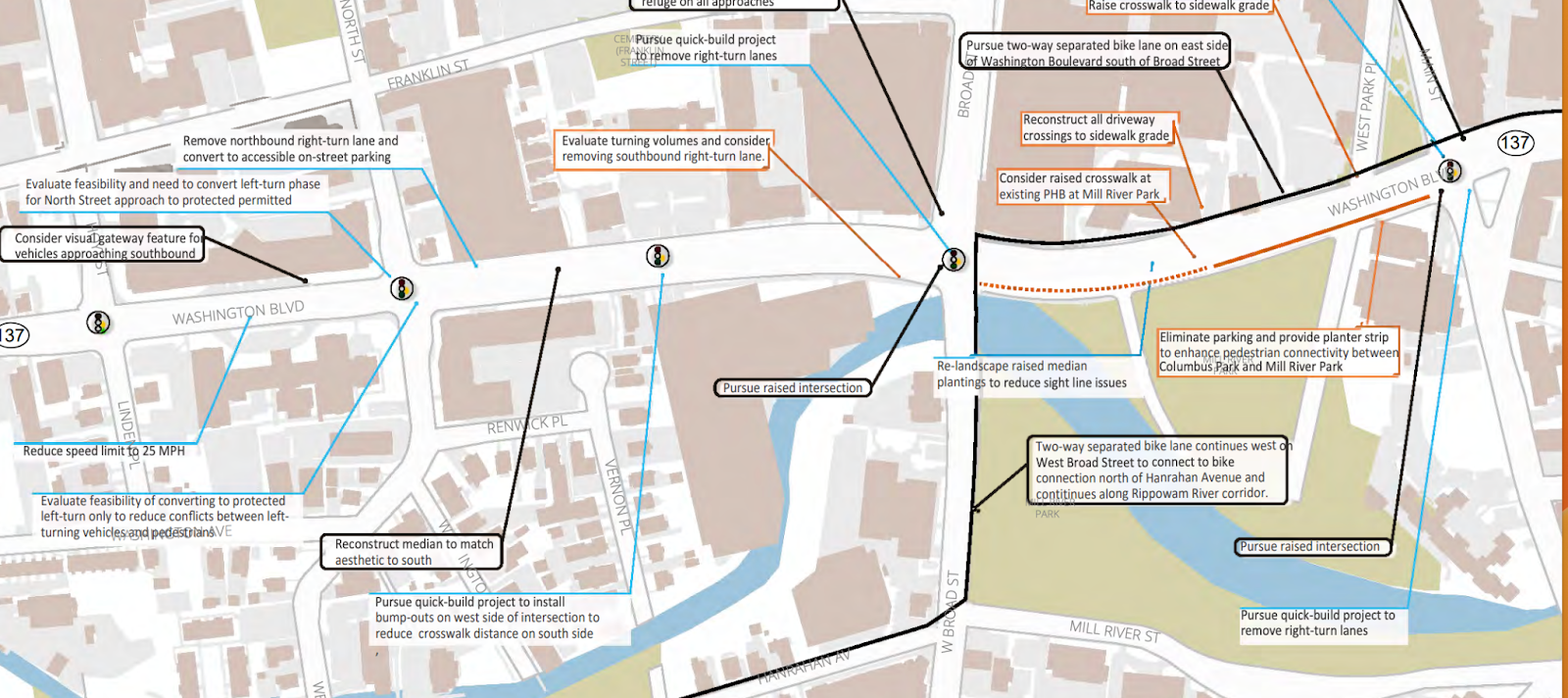
Some of the recommendations from the audit include reducing the speed to 25 miles per hour; pursuing “quick build projects,” like adding bumpouts, which shorten the distance for people crossing the street; raising crosswalks to force drivers to slow down; removing turn lanes to limit the interactions between pedestrians and drivers; and improving landscaping to help sight lines.
The Role of Speed in Crashes
Studies have shown that roadway designs which encourage drivers to go slower, such as narrower lanes, can reduce the number of overall crashes but more importantly, the number of fatal crashes. If a crash occurs at a lower speed—even if it involves a pedestrian—the survival rates are much higher.
Sarah Roy, a pedestrian and traffic safety advocate in Fairfield, said that she’s seen firsthand how roads designed in town are built to move cars only.
“It's all about the throughput of cars. How do we get a car from point A to point B as efficiently and fast as possible, to the detriment of all other experiences and uses?” she said.
Roy said that she became “radicalized” about safety on the roads soon after moving to Fairfield in 2016. She and her son went out for a bike ride, and he made a wrong turn out of their street onto a busier road.
“He turned right into Wilson. Street and almost got hit by a car—car horns were blaring, people were screaming. I was screaming at the people, and he was traumatized and he didn't want to ride his bike for weeks,” she said. “That's what started me on the journey of thinking—how is it that we've designed this neighborhood—Fairfield is all about the schools, it's very family oriented—how is it that as soon as we walk out the door, we're in danger of getting hit by cars? That makes no sense to me.”
Roy, who used to also be a member of the town’s Bike/Walk Commission, said that she’s been working with residents to help educate local leaders on road safety issues, through taking them on walks along roads, such as Villa Avenue, that don’t feel safe for pedestrians.
“Villa Avenue, it's a cut through between Bridgeport and Fairfield, and people just fly down this road, it’s 25 miles an hour [speed limit]. It's densely populated, full of families,” she said. “The neighbors invited all of the RTM to come do a walk audit with them to walk the street and experience how dangerous it is.”
Next Steps
Now that we’ve outlined some of the challenges on the roads, we’re going to be diving into two ways communities are looking to address them with our next two parts in this series.
First, we’ll be looking into how communities are reimagining their roadways through policies and action plans, including Vision Zero—an effort to reduce the number of traffic-related deaths in a community to zero—and Complete Streets—a set of policies that aim to make the roads safer for all users.
Then, we’ll be highlighting some infrastructure projects underway across southwest Connecticut that aim to improve some of the most challenging areas.
See all our reporting on our Getting Around page.