Norwalk Focuses on the Waterfront
There are multiple initiatives in Norwalk that involve the city's coastline, including a waterfront study and a grant to plan for coastal resiliency.
With more than 20 miles of coastline and even more along rivers, water is at the heart of Norwalk’s economy and community. Because of that, there’s multiple initiatives, projects, and studies related to the waterfront that we wanted to explore.
Waterfront Study
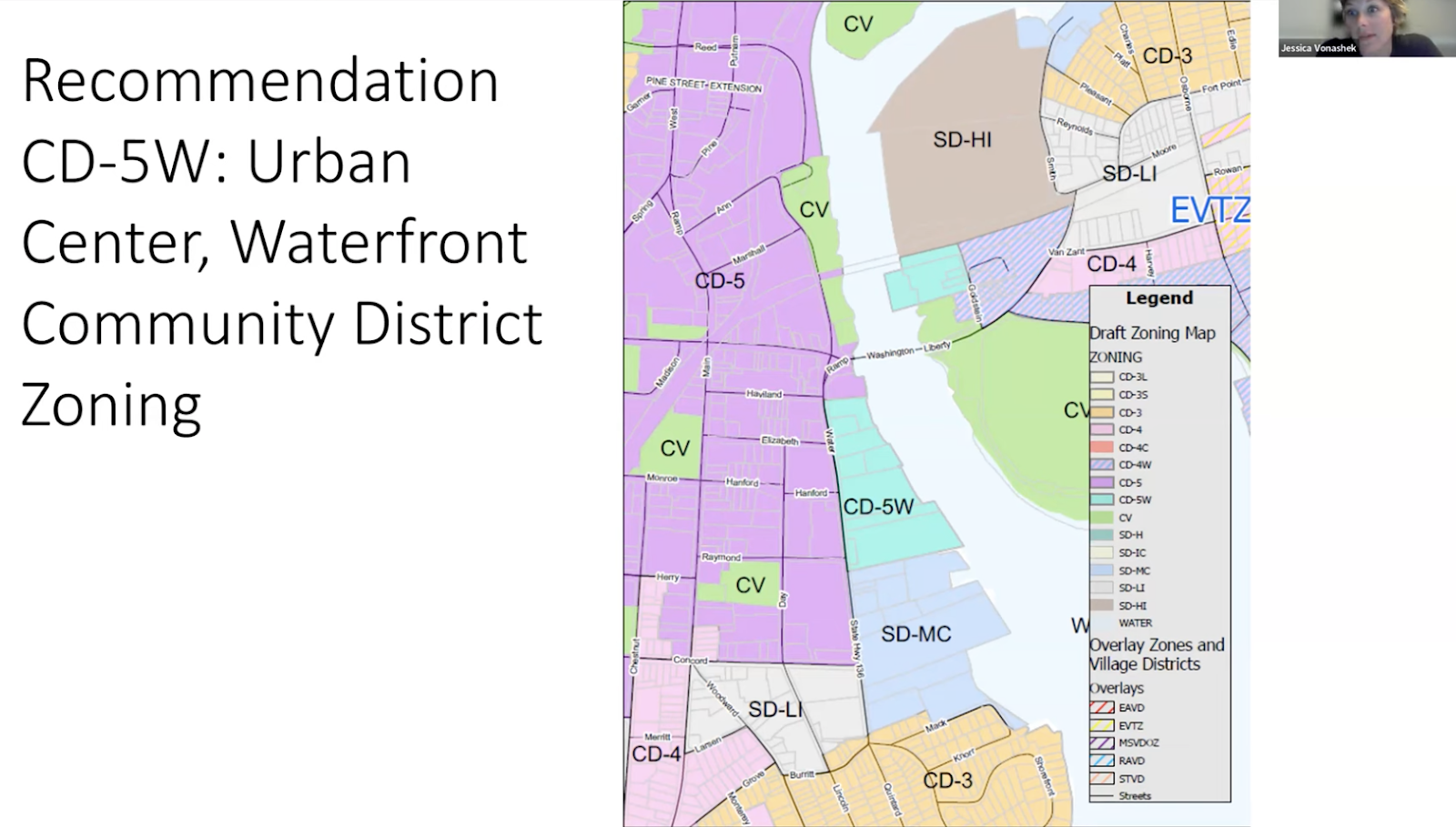
As a part of the city’s study of industrial zones, it reviewed areas along the Norwalk River to study separately. Earlier this month, Jessica Vonashek, the city’s chief of Economic and Community Development, gave an update on proposed zoning along the waterfront.
Vonashek said that the city heard the concerns from the council’s Economic and Community Development Committee about keeping areas along the river zoned for heavy industrial uses. That’s why they’re recommending zoning most of the land along the river to a mixed zone “CD-5W,” which is a “water-community district” that allows for a variety of uses, such as artist space, multi-family housing, retail, restaurants, and entertainment.
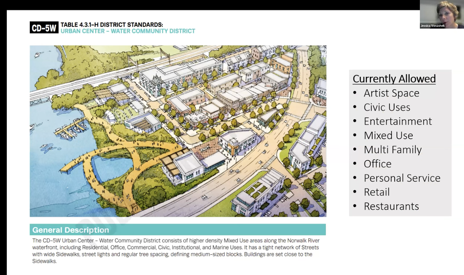
“When we looked at all of the concerns, this was a really good potential solution,” Vonashek said. “It’s really important that along this particular corridor we have public access to the water.”
This zone would balance adding some density—potentially allowing for 4-story buildings—with public access to the water and “active” uses like restaurants with outdoor dining that would be a draw for people to the area.
“What we’re thinking is, how do you activate that space with really great restaurants and really great markets and really good pedestrian walkways so that people that are accessing downtown and are walking around…and can walk down a pedestrian lane way to the water,” Vonashek said.
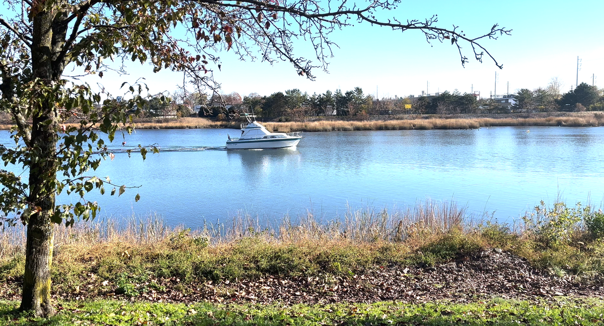
The proposed zoning would keep some areas, just north of I-95, zoned for industry, which would support jobs in the area and make sure that dredging of the river occurs so boats can move up and down it.
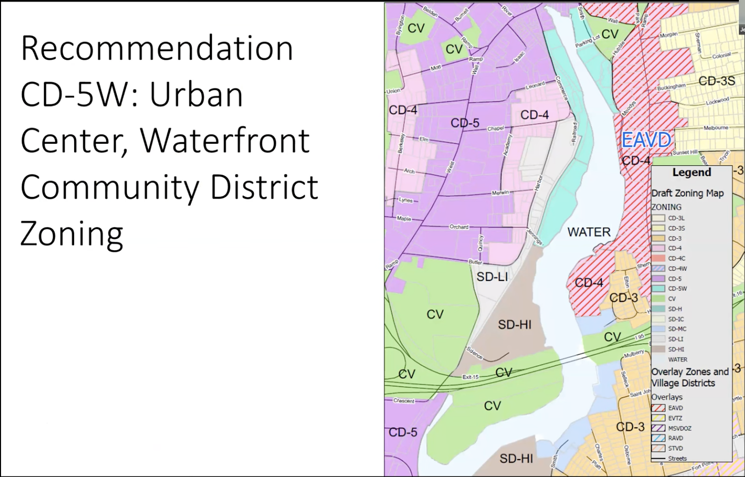
Along Water Street, there would be the “CD-5W” mixed use zone up closer to Washington Street, before transitioning to a marine commercial zone, which would allow for uses like boat repair.
“We’re trying to balance the public access piece with the marine commercial piece more than anything,” she said, adding that they’re looking for ways to draw people down to the water. “Right now on Water Street you can't even see the water—that's part of what we’re trying to look for.”
Council member John Kydes, chair of the committee, said that this update showed the city “definitely heard what the committee had to say.”
Vonashek emphasized that changing the zoning wouldn’t kick out or remove any current business or operations—those would be grandfathered in. This was more about planning for the future, so that when a property is sold, that’s when the use could be changed and updated to meet the new zoning.
This was a presentation for informational purposes, Vonashek said. The next step, since the council members reacted favorably to this recommendation, is to fully add it to the plan and bring it to the committee next month for a vote on it. If approved, it would go to the full Common Council, which would vote to add the Waterfront Study to its 10-year overall city plan and the recommendations in this plan would be added to the city’s overall zoning code update.
Increasing Coastal Resiliency
While there are multiple benefits to being located along the water, the city also faces challenges like flooding that come from being close to it. That’s part of why the city is receiving a $211,750 grant from the National Fish & Wildlife Foundation to support coastal resilience efforts.
“It’s a focus on natural infrastructure and its role in protecting the built infrastructure,” said Alexis Cherichetti, the city’s senior environmental officer. “It is not going to focus on the stormwater infrastructure system—which is a beast separate than what we’re able to tackle—but it would focus on river, rain flooding, coastal flooding due to both the nuisance tidal flooding we’re seeing and storm surge, coastal storm flooding.”
The funding would be used to hire a consultant that would help conduct community outreach and draft a plan to demonstrate ways the city could work to add “natural infrastructure and habitat restoration” along the coastline to deal with some of the flood-related challenges.
The project’s abstract states that it will outline “solutions for improved flood resilience” that are “supportive of fish and wildlife habitat in Long Island Sound” and include items like “green infrastructure, reduction of stormwater runoff volumes through increased capture and filtration, and management of coastline to allow habitat adaptation with sea level rise.”
Cherichetti said having the plan in place will allow the city to use it to get more grant funding to actually implement some of the suggested solutions.
“This is that foundational study and plan that will document proposed implementation projects that involve natural infrastructure and habitat restoration,” she said.
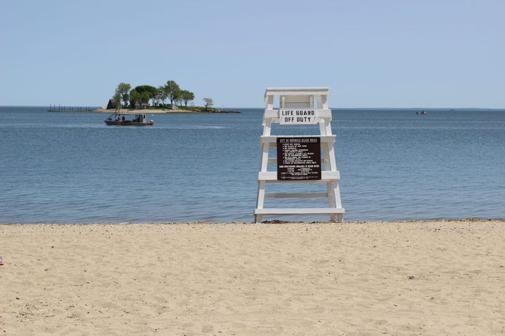
More Public Access to the Waterfront
As Vonashek noted in the waterfront study discussion, increasing public access to the water is a priority of the city. That’s part of why it received a $44,000 grant from the Connecticut Port Authority’s Small Harbor Improvement Projects Program to evaluate 16 sites that are owned by the city at the end of streets that back up to the water.
“There are several areas within the city that have street ends that are either inaccessible to the public or have possibly been taken over by a neighboring property owner for their own property when in fact it’s city property, denying the public access to the water,” said Steve Kleppin, the city’s director of planning and zoning, in sites ranging from East Norwalk to Shorefront Park to Woodward Avenue.
That’s why the city’s Harbor Management Commission applied for this grant to evaluate these street ends, Kleppin said.
“We’ve identified at least 16 right now that we’re going to take a look at and then pick five of those that we’re going to develop an improvement plan for,” he said.
That could be adding a public boat launch or slip to the water, but he said that the idea would be “consistent with what the neighborhood is” and not be a major attraction that would impact the surrounding homes.
“It’s an idea to reclaim the waterfront, to get access to that waterfront for different parts of the community,” he said.